


A “brutal” storm system brewing over the Pacific Ocean is set to slam into Northern California on Wednesday, wreaking havoc on a region already reeling from record rainfall and flooding.
According to the National Weather Service in San Francisco, which offered an illustration of the approaching storm, the storm could drop up to 8 inches of rain in certain locations, falling on already overflowing rivers and saturated soils.
“The impacts will include widespread flooding, roads washing out, hillside collapsing, trees down (potentially full groves), widespread power outages, immediate disruption to commerce, and the worst of all, likely loss of human life,” the weather service warned in a statement. “This is truly a brutal system that we are looking at and needs to be taken seriously.”
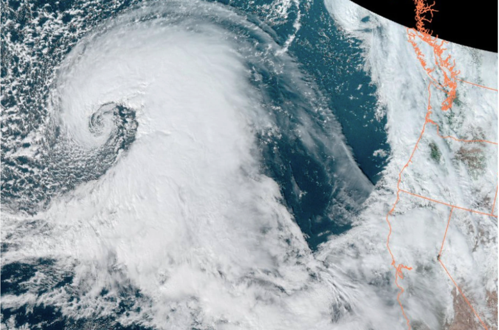
Over the weekend, meteorological phenomena known as an “atmospheric river” swept across most of the state, dumping more than 5 inches of rain on San Francisco and nearly 10 inches elsewhere.
On Wednesday, the state will be hit by another atmospheric river, or, as it was known a few years ago, a Pineapple Express. These are strong rainstorms that form as a band of warm, moist air moves from the Hawaiian Islands across the Pacific Ocean to the West Coast.
Water vapor falls as heavy rain when it reaches the cooler air over the western mainland. Atmospheric rivers are lengthy, flowing sections of the atmosphere that transport water vapor across a 250 to 375-mile-wide stretch of sky. They can stretch for more than 1,000 miles and transport more water than the Mississippi River.
More storms are possible next week
According to Daniel Swain, a climate scientist at the University of California, Los Angeles, the storm could affect a wide swath of coastal California, ranging as far south as Los Angeles and far north as San Francisco.
The northern region of the state will be hit the worst. Because the earth is already saturated from the New Year’s Eve storm, he believes Wednesday’s storm will bring localized mudslides from Monterey Bay along the coast. According to him, there is a high probability of flash floods, urban flooding, shallow landslides, and mudslides, but major river flooding is unlikely.
“The big wild card is what happens next week,” Swain said, warning that one and possibly two more atmospheric river events target the coast in the coming days. “Then all bets are off and the potential for much more significant flooding could very realistically emerge.”
Snowy winter so far in Midwest
Heavy snow, considerable freezing rain, and sleet were anticipated across most of the Midwest on Tuesday and Wednesday. Snowfall rates of 1-3 inches per hour, accompanied by thunder in some cases, were predicted for sections of Nebraska, South Dakota, and Minnesota.
Throughout the day Tuesday, gusty gusts of 30 mph will cause areas of blowing and drifting snow. The precipitation will cause snow-covered roadways, decreased visibility, and “difficult-to-impossible travel,” according to the National Weather Service.
Snowfall totals for the young season are already significantly above average in much of the country’s Plains and Upper Midwest. AccuWeather states that Minneapolis has received 32.6 inches of snow since November 1, compared to an average of 18 inches. Rapid City and Sioux Falls, South Dakota, as well as Fargo, North Dakota, have also been affected.