

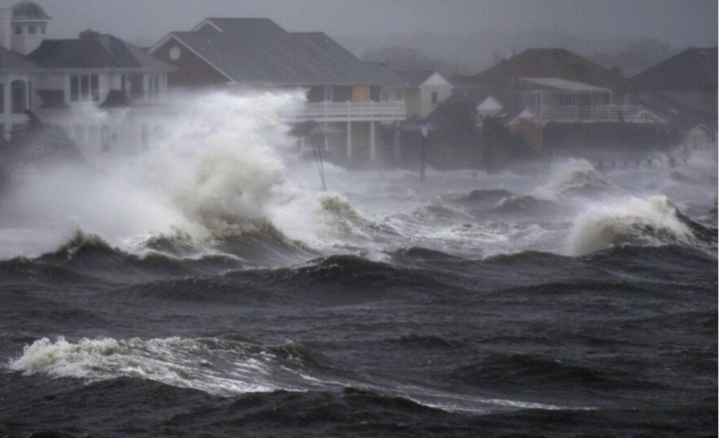

Weather forecast reports reveal hurricane Ian as a category 4 storm as it heads to Florida. Excessive rainfall, powerful winds, and surging storms are expected.
Current updates on hurricane Ian:
Hurricane watches were on high alert along the stretch of Florida‘s western coast as hurricane Ian is gaining strength. As per AccuWeather forecasters, the fourth hurricane of 2022’s Atlantic hurricane weather is rapidly gaining intensity. In the next few days, it is going to develop into a category four hurricane in the Gulf of Mexico. As of 11 am EDT on Monday, Hurricane Ian sustained winds up to 80 mph. It is currently moving towards the northwest at 13 mph. “Ian was located about 100 miles west of Grand Cayman Island and 240 miles southeast of the western tip of Cuba,” stated the National Hurricane Center.
Despite the historical quiet beginning of this year’s Atlantic hurricane season, the flurry of tropical activity is changing the course of the season. Florida Governor Ron DeSantis declares a statement of emergency for the State. He also urged residents to start preparing for the impacts. Additionally, he activated the National Guard for helping with possible landfall and set up power crews to help in the power renewal after the storm.
More on the weather status

:quality(70)/cloudfront-us-east-1.images.arcpublishing.com/cmg/EUCXH3UTLBEKFCZJKSHUQL3UYY.png)
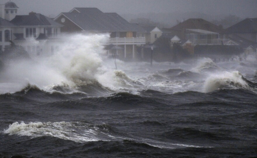
Currently, hurricane Ian is a Category one. However, forecasters reveal a high likelihood of things changing for the worse owing to wind shear. “A quick uptick in strengthening is expected early this week as Ian moves into the western Caribbean, where low wind shear and very warm water are in place. This will raise the likelihood of significant impacts in the western Caribbean, and eventually the United States,” explained Adam Douty. Douty is a Senior Meteorologist at AccuWeather. “By Tuesday, Ian may be a dangerous major hurricane,” he added.
The storm’s worst impact may occur in western Cuba, where it is strengthening and moving north. Hurricane warnings were issued for several parts of the island and conditions began worsening on Monday. Flooding is on the rise as strong winds are pushing water ashore. “If the jet stream can dip southward early, Ian could be steered into the west coast of Florida before interacting with high wind shear, causing the hurricane to be much stronger at landfall. On the other hand, a slower jet stream arrival could allow Ian to drift toward the northern Gulf Coast, where high wind shear would drop the wind intensity before landfall,” stated Douty.